THE last time I wrote about the development of the 2026/2027 El Niño was on 14 June 2026, three days after the Climate Prediction Center of the United States National Oceanic and Atmospheric Administration (NOAA) officially declared the onset of the phenomenon.
Nearly three months have now passed. The 2026/2027 El Niño has completed its first phase, June–July–August (JJA), and continues to strengthen as it moves into the next phase.
Its development is expected to continue until it reaches its peak towards the end of the year, before gradually weakening by March–April–May (MAM) next year.
The important question now is no longer simply whether this El Niño will become strong. Attention is increasingly focused on how strong it will become, what its impacts will be on our region, and how well prepared we are to face them.
In this article, I share the latest developments in the Pacific Ocean, the conditions experienced across our region during JJA, and what we can expect over the coming months.
El Niño has reached the strong category
The latest updates from various sources indicate that this El Niño continues to strengthen and has the potential to develop into a very strong or extreme event.
According to the US Climate Prediction Center, there is approximately a 98 per cent probability that this El Niño will reach the very strong category, with sea-surface temperature anomalies in the Niño3.4 region exceeding 2.0°C.
At the same time, reports from Australia’s Bureau of Meteorology (BOM) indicate that warming in the region had reached approximately 2.2°C by early August, considerably higher than the 0.8°C threshold associated with El Niño conditions during August.
These developments indicate that the 2026/2027 El Niño has entered the strong phase. The large amount of heat stored beneath the ocean surface in the central and eastern Pacific is also expected to drive further increases in sea-surface temperatures over the coming months, potentially strengthening the episode further.
If warming in the Niño3.4 region continues to increase and approaches or exceeds 3.0°C towards the end of the year, this episode could become one of the strongest El Niño events ever recorded.
Under such circumstances, the popular term ‘super El Niño’, often used by the media, may have some justification, although the term itself is not generally used in scientific studies of El Niño.
The current haze is not unexpected
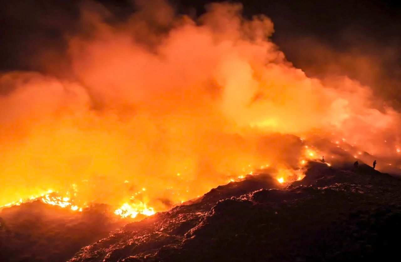
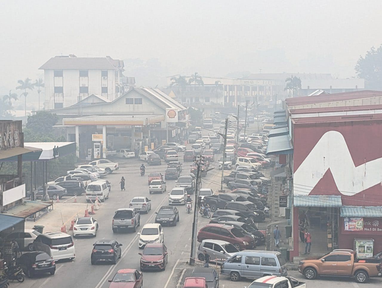
At present, we are experiencing a transboundary haze episode associated with forest and peatland fires in Kalimantan and southern Sumatra, based on the distribution of hotspots detected by satellite observations.
However, some of the haze experienced in particular areas may also originate from local sources.
Several areas in Sarawak and Peninsular Malaysia have experienced significant haze, with Air Pollution Index (API) readings reaching unhealthy levels. Indeed, last week, more than 500 schools in Sarawak were reportedly closed when API readings exceeded 200.
To me, the situation feels almost like a ‘replay’ of what we experienced during previous strong El Niño episodes, particularly 1997/98 and 2015/16, as well as during other, less intense events.
When a strong El Niño occurs, much of the southern part of Southeast Asia typically experiences reduced rainfall. Soils and vegetation become progressively drier. Peatlands lose moisture and become increasingly susceptible to fire. When fires occur on a large scale, smoke can be transported by winds across national borders.
This is why the relationship between El Niño, drought, forest fires and haze should be viewed as a chain of interconnected risks that can be anticipated and, at least to some extent, prevented.
JJA: Indonesia was drier, but parts of Peninsular Malaysia continued to receive rainfall
During June, July and August, many parts of Indonesia, including Kalimantan and southern Sumatra, experienced drier conditions.
Interestingly, central Sumatra and the central and southern parts of Peninsular Malaysia continued to receive relatively high rainfall.
In Kuala Lumpur, for example, conditions during July resembled those normally experienced during the inter-monsoon months of April or May, when frequent local convective activity produces thunderstorms and flash floods.
These conditions do not necessarily contradict the influence of El Niño. In fact, they are consistent with our theoretical and scientific understanding of how El Niño affects atmospheric circulation and sea-surface temperature patterns across the region.
The influence of El Niño on rainfall in Southeast Asia is not uniform across every location or every month. El Niño affects large-scale atmospheric circulation with rainfall over a particular area is also influenced by regional patterns of atmospheric divergence and subsidence in response to warming in the Pacific Ocean that changes the east–west Walker circulation.
However, these changes are also modulated by the changing seasons.
SON: the risk of drought, fires and haze remains high
As we enter the second phase, September–October–November (SON), dry conditions are expected to persist over Kalimantan and southern Sumatra.
This means that the risk of forest and peatland fires remains high. As long as these areas remain dry and fires continue, the threat of transboundary haze has not passed.
At the same time, reductions in rainfall are expected to become more pronounced in parts of Peninsular Malaysia, Sabah and Sarawak.
If dry conditions persist, the risks will extend beyond forest fires and haze. We also need to prepare for drought, pressure on water resources, impacts on agriculture, rising temperatures and heat stress.
DJF: the risk shifts towards northern Borneo
As we move into December–January–February (DJF), conditions are expected to change. Kalimantan and southern Sumatra are expected to receive more rainfall again.
Consequently, the threat of drought and fires in these areas should begin to diminish. In some locations, increased rainfall could instead bring a risk of flooding. Southern Sarawak may also experience wetter conditions.
However, this does not mean that the influence of El Niño on our region will have ended. Rather, the focus of risk is expected to shift towards northern Borneo.
Northern Sarawak, Brunei and Sabah are likely to continue experiencing drier-than-normal conditions. Prolonged hot weather and reduced rainfall could increase the risks of drought, forest fires and local haze episodes. Peat areas in Miri and Sabah, particularly Binsuluk, are likely to face high risk of fire outbreak.
MAM: Sabah and northern Peninsular Malaysia need to remain vigilant
During the final phase, March–April–May (MAM), El Niño is expected to begin gradually weakening. However, its effects on rainfall and temperature will not necessarily disappear immediately.
Sabah could continue to experience hot and dry conditions. Peninsular Malaysia may also experience hotter and drier conditions, particularly in the north. This means that even when global attention begins to shift elsewhere as the El Niño indices decline, preparedness at the local level must continue.
We have been through this before
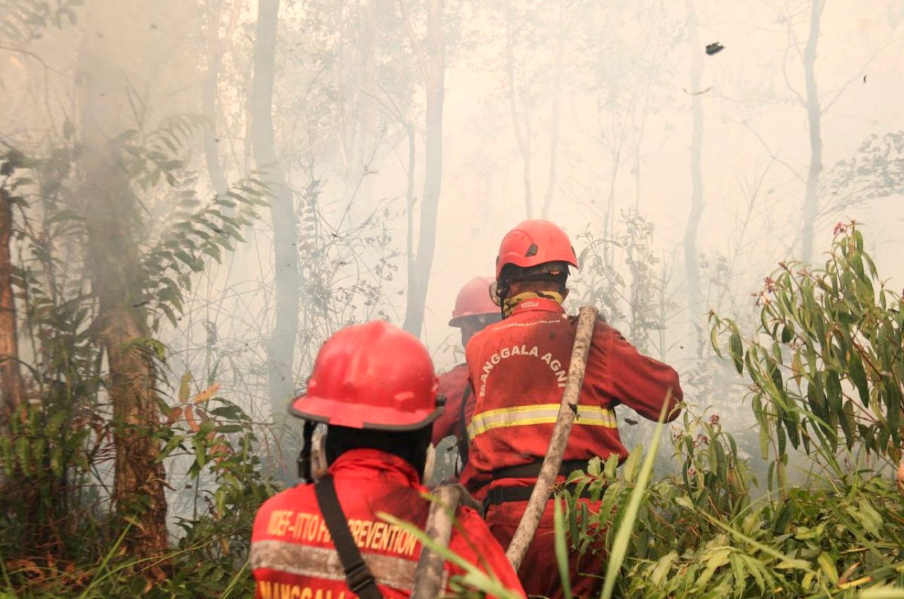
The pattern currently developing bears similarities to what we experienced during previous strong El Niño episodes, particularly those of 1997/1998 and 2015/2016.
We have seen before how a strong El Niño can bring prolonged drought, large-scale forest and peatland fires, transboundary haze, disruptions to health and education, and substantial economic losses.
Therefore, if the 2026/2027 El Niño does indeed develop into one of the strongest events ever recorded, we should not wait until its impacts become critical before taking action.
From reactive to proactive
This is perhaps the most important issue. Today, our climate science capabilities are far more advanced than they were several decades ago.
The development of El Niño can be continuously monitored, and the probability of a strong event can be identified several months in advance.
We have model to predict and satellite for observations. We can monitor hotspots. We know where the high-risk peatlands are located. We have seasonal rainfall forecasts. We also know from past experience that a strong El Niño increases the risks of drought, fires and haze across our region.
Yet when major fires and haze occur, our response still often appears reactive rather than proactive. ASEAN already has the ASEAN Agreement on Transboundary Haze Pollution.
However, when severe haze episodes continue to recur, we should ask how effectively the existing mechanisms are being translated into preventive action on the ground.
An El Niño forecast issued six to nine months in advance should translate into action six to nine months in advance — not action taken only after major fires have already started.
High-risk areas should be identified early. Peatland water levels need to be managed. Open burning needs to be more strictly controlled. Firefighting teams and water resources should be deployed in advance to high-risk areas.
Hotspot monitoring should be followed by immediate action on the ground. Cooperation between countries should also be mobilised before smoke crosses national borders, not only after haze has become a regional crisis.
Are we prepared?
The question of preparedness becomes even more important in a warming world. Scientific studies indicate that climate change has the potential to alter the characteristics of El Niño and increase the risk of extreme El Niño events in a warmer climate.
At the same time, rising global temperatures can exacerbate the impacts of drought and fire when dry conditions occur.
The 2026/2027 El Niño, therefore, is not simply another climate phenomenon that we have to endure. It is also a test of our ability to use scientific knowledge, climate forecasts and lessons from past experience to reduce risks before disaster strikes.
We already know the risks.
We have the experience of 1997/1998 and 2015/2016. We have monitoring and forecasting systems that are far more advanced. And this time, we also have months of advance warning.
The question is: Are we prepared?
Professor Emeritus Dr Fredolin Tangang is Professor Emeritus in climatology and climate change at Universiti Kebangsaan Malaysia, a Fellow of the Academy of Sciences Malaysia, and is currently based at Universiti Brunei Darussalam. He is a former Vice-Chair of Working Group I of the United Nations Intergovernmental Panel on Climate Change (IPCC).