Screenshot
WE are currently at the end of the Northeast Monsoon season, which typically ends towards the end of March each year, after which we will enter the inter-monsoon phase during April and May.
The inter-monsoon phase brings weather conditions dominated by local convective systems, which usually result in thunderstorms and short-duration heavy rainfall, potentially leading to flash floods.
These conditions are particularly pronounced along the west coast of Peninsular Malaysia.
As we transition into the inter-monsoon period and subsequently into the Southwest Monsoon, Malaysia’s weather will be influenced by climate variability, particularly the Madden–Julian Oscillation (MJO).
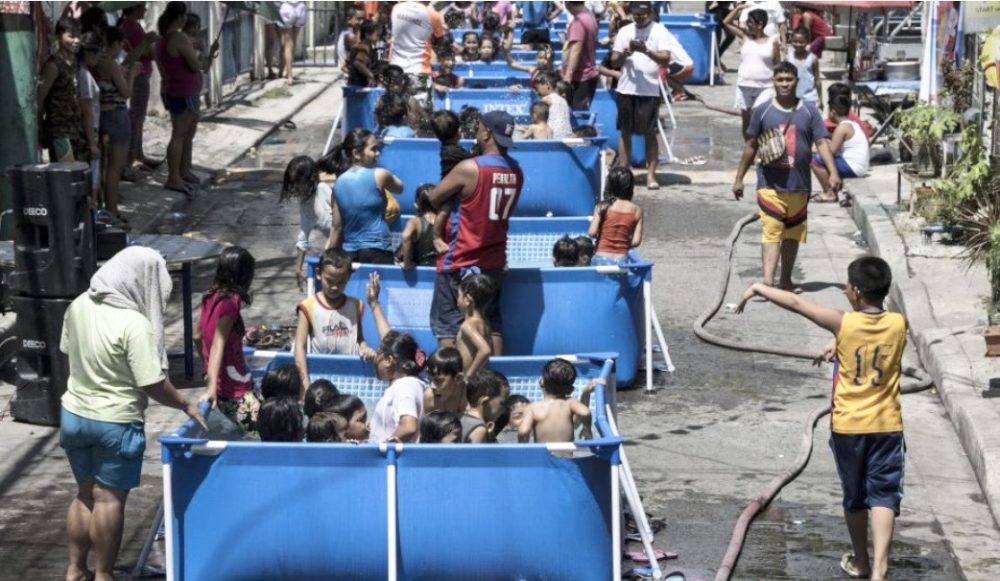
At the time of writing, weather conditions in Malaysia are relatively hot, especially in the northern parts of Peninsular Malaysia, due to suppressed convection associated with the MJO across Southeast Asia, as forecast by the Climate Prediction Centerin the United States.

The explanation for these hot conditions during suppressed MJO convection is straight forward: the region is dominated by high atmospheric pressure, which inhibits convection, reduces cloud cover, and consequently allows increased solar radiation to reach the Earth’s surface, enhancing heat absorption.
The absence of rainfall also reduces evaporative cooling, potentially leading to heatwaves. Typically, these conditions are temporary, as the suppressed convection centre moves eastwards within 1–2 weeks and is replaced by an enhanced convection centre that follows behind.
As we enter the inter-monsoon phase, we are also approaching the final stage of the La Niña event that began in mid-2025. Subsequently, the El Niño–Southern Oscillation (ENSO) is expected to transition into a neutral phase.
ENSO is a natural oscillation driven by coupled ocean–atmosphere interactions in the Pacific Ocean. It fluctuates irregularly between El Niño, La Niña, and neutral conditions, with El Niño–La Niña cycles typically occurring every 2–5 years.
The Pacific Ocean, being the largest ocean on Earth, allows ENSO to influence weather and climate across the globe.
The El Niño phase can elevate global temperatures. For instance, 2024 was declared the warmest year on record due to the combined effects of global warming and El Niño, with global temperatures reaching 1.55°C above pre-industrial levels.
In 2025, temperatures slightly decreased compared to 2024 due to the cooling influence of La Niña. However, continued global warming ensured that 2025 remained the third warmest year on record.
What about 2026? Will it become the hottest year ever recorded? In my view, the probability is high. According to forecasts from the Climate Prediction Center in the United States, El Niño is expected to return in 2026, around July–August, intensify towards the end of the year and early 2027, and begin to weaken by March–April before ending around May the following year.
The probability of El Niño developing during the Southwest Monsoon exceeds 70%, increasing to approximately 80–90% towards the end of the year.
How does El Niño occur, and how does it influence weather and climate in Malaysia and Southeast Asia? This has been a favourite subject of mine throughout my years of teaching at Universiti Kebangsaan Malaysia and currently at Universiti Brunei Darussalam.
My PhD research at the University of British Columbia nearly 30 years ago focused on El Niño prediction. Since returning to UKM in 1997 until my retirement in 2023, my research and that of my group have largely concentrated on El Niño and its impacts on weather and climate in Malaysia and the region, including Indonesia.
The predictive model developed during my PhD was later adopted as one of the operational El Niño forecast models at the Climate Prediction Center in the United States until 2018, when it was replaced by more advanced multi-model systems.
Why does El Niño affect weather in Malaysia and Southeast Asia, despite the Pacific Ocean being thousands of kilometres away? This is related to the east–west atmospheric circulation known as the Walker Circulation.
Under normal conditions, Southeast Asia is influenced by easterly winds from the Pacific Ocean and westerly winds from the Indian Ocean, making it a region of moisture convergence from both oceans.
However, during El Niño events, warming in the central and eastern Pacific weakens the easterly winds blowing towards Southeast Asia. As a result, the region becomes dominated by high pressure, and moisture shifts away towards the central Pacific and western Indian Ocean.
The mechanisms behind El Niño are complex and cannot be fully explained within the scope of this article. However, they are closely linked to a see-saw behaviour of the thermocline in the Pacific Ocean.
The thermocline is the layer that separates warm surface water from colder deep water. In the western Pacific, it is typically located at depths of around 200–300 metres, whereas in the eastern Pacific it is much shallower, at approximately 50 metres.
If we visualise a cross-section of the Pacific Ocean, the thermocline behaves like a see-saw, with its depth controlled by Kelvin waves propagating from west to east.
El Niño conditions develop when the thermocline is depressed, while La Niña occurs when it is elevated relative to normal conditions. A depressed thermocline in the eastern Pacific weakens the upwelling of cold water to the surface, leading to increased sea surface temperatures and the onset of El Niño conditions.
At present, these signals are only beginning to emerge at the surface in the eastern Pacific. However, conditions in the subsurface Pacific are already concerning—akin to “a fire beneath the ashes”—with a widespread and significant deepening of the thermocline from west to east.
Based on my experience of over three decades researching El Niño, I believe we are likely to face a strong El Niño event this year, extending into early next year.
In addition, a positive phase of the Indian Ocean Dipole (IOD) is also forecast towards the end of the year. These combined conditions raise the risk of severe dry weather, forest fires, and transboundary haze events. We must be prepared.
Emeritus Professor Dr Fredolin Tangang is a climatologist and climate change expert, Emeritus Professor at Universiti Kebangsaan Malaysia, Fellow of the Academy of Sciences Malaysia, and currently affiliated with Universiti Brunei Darussalam. He is a former Vice-Chair of Working Group I of the Intergovernmental Panel on Climate Change (IPCC), United Nations.