
IN my column published on 25 November 2025, I wrote about the severe and extensive flooding in central and eastern Vietnam, and in southern Thailand, including Hatyai, which was hit exceptionally hard.
Thousands of residents were trapped, including Malaysians stranded in Hatyai, and it was reported that the Malaysian government deployed rescue teams to assist in evacuation operations and to bring home those affected.
At the time the column was written, persistent heavy rainfall had also struck the northern part of Peninsular Malaysia, including Kedah, Perlis, Kelantan and Terengganu.
During that period, the weather conditions and prolonged heavy rain in these areas could be linked to the first cold surge since the Northeast Monsoon (NEM) was declared to have begun on 13 November 2025 by MetMalaysia.
Around the same time, the website of the Joint Typhoon Warning Center (JTWC) based in Hawaii began showing the formation of three tropical storm systems: one south of the Philippines, one in the Indian Ocean to the east and south of Sri Lanka, and another in the Strait of Malacca.
Two days later, these systems intensified: Typhoon Koto was moving into the central South China Sea, Cyclone Ditwah had formed in the eastern Indian Ocean and was heading towards Sri Lanka, while in the Strait of Malacca, Tropical Storm Senyar developed and was located east of Aceh.
Seeing these three systems appear simultaneously on my laptop screen reminded me of the film The Day After Tomorrow (2004), which depicted three hurricanes occurring at the same time—one in Asia, one in Europe and one in North America.
While observing Koto, Ditwah and Senyar swirling on the computer screen, I—being a climatologist studying climate change—realised that this was extraordinary, perhaps unprecedented, and I felt a sense of excitement.
‘Excitement’ here does not mean I wished for such events to happen.
Hundreds of people had lost their lives in Vietnam, Thailand, Sumatra, Sri Lanka, and even in Malaysia, although fatalities here were far fewer.
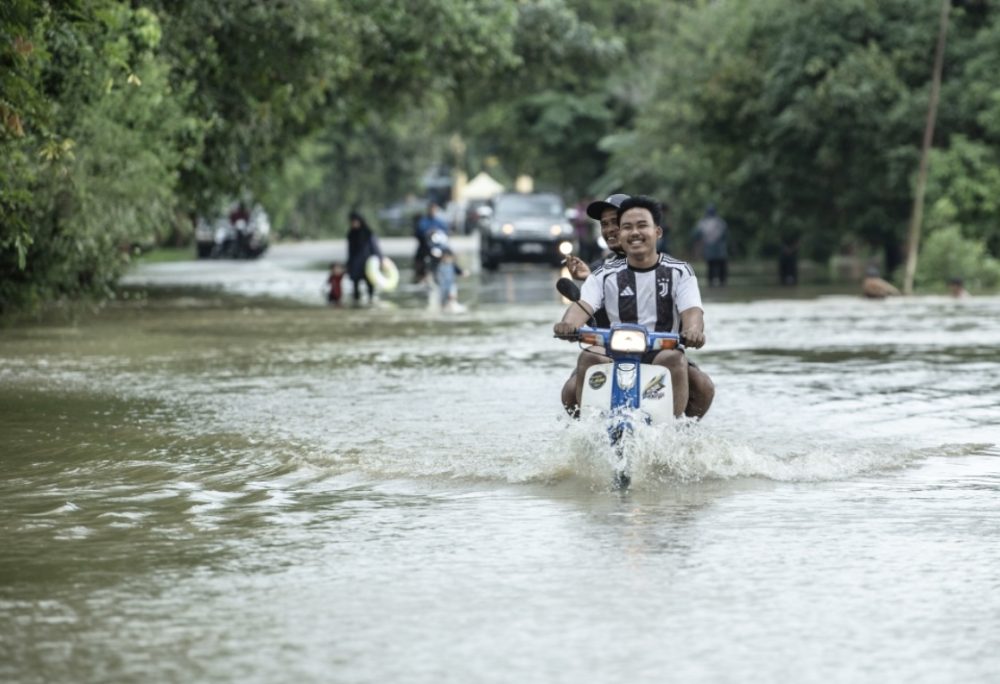
Seremban and Port Dickson in Negeri Sembilan were among the locations affected by Tropical Storm Senyar, which recently entered the waters of the Strait of Malacca, bringing continuous heavy rain, strong winds and rough seas.

The storm saw a Proton Saga damaged by a fallen tree in Port Dickson and six residents in Seremban evacuating their homes due to a landslide. (JBPM pic)
Imagine the destruction of property, the financial losses, and the hardships endured by affected communities in all these areas.
Sympathy naturally arises in the hearts of all of us who have followed these developments, myself included.
As this article is being written, flooding continues in many parts of Peninsular Malaysia, Sumatra, Thailand and Sri Lanka. Ditwah is likely to cause flooding and severe weather in eastern India, while Koto threatens central and eastern Vietnam.
I was ‘excited’ thinking about the atmospheric conditions that gave rise to this extreme weather chaos. I pondered the probability of multiple phenomena—cold surge, Ditwah, Senyar and Koto—occurring simultaneously.
In my assessment, the likelihood is extremely small; it has probably never happened before. In fact, Tropical Storm Senyar is the first ever recorded to have formed in the Strait of Malacca.
Recent flooding in Kedah.
Malaysia has only ever been struck by two tropical storms: Tropical Storm Greg, which hit Sabah—particularly Keningau—in 1996, and Tropical Storm Vamei (reported to have briefly reached typhoon strength), which struck southern Johor in 2001.
The track of Senyar is also interesting. It formed in the northern Strait of Malacca, moved westward near eastern Aceh and intensified, then made a U-turn southwards towards western Selangor, making landfall between Selangor and Negeri Sembilan around midnight on 27 November 2025.
It then weakened while crossing Peninsular Malaysia, and as this piece is being written, Senyar is already over the South China Sea. Forecasts suggest that the remnants of Senyar will be absorbed by Koto.
Residents in Selangor, Kuala Lumpur and Negeri Sembilan were understandably anxious about the impact of Tropical Storm Senyar, given the experience of the 2021 tropical depression that caused severe weather disruption and major flooding in the Klang Valley.
The intensity of a tropical depression is lower than that of a tropical storm. We are fortunate that the impact of Senyar was less severe compared with Sumatra and Aceh.
Senyar was also smaller in size and intensity than Koto and Ditwah, and significantly smaller than Super Typhoon Fung-Wong (also known as Uwan), which struck the Philippines in early November 2025 and was almost the size of the entire country.
Speaking of typhoons in the Philippines, it compels me to comment on how dramatic the typhoon season has been in 2025. The Philippines and Vietnam have been struck repeatedly.
On average, around 20 tropical storms and typhoons form each year, of which 8–9 reach typhoon intensity.
This year, up to the end of November, the total number of storms and typhoons has far exceeded the average.
There have already been 14 typhoons, five of which were strong typhoons—including Ragasa and Fung-Wong, both classified as super typhoons.
Typhoon formation and extreme weather conditions are heavily influenced by sea surface temperatures. Warmer seas contribute to the frequency and intensity of tropical storms and typhoons.
The year 2025 is unique. A La Niña event is occurring, strengthening easterly winds and channelling moisture into Southeast Asia—providing ‘fuel’ for extreme weather.
At the same time, warm waters in the western Pacific are being pushed towards the region east of the Philippines, triggering back-to-back intense typhoons.
Meanwhile, in the Indian Ocean, a negative-phase Indian Ocean Dipole (IOD) event is under way, altering atmospheric circulation in a way that also directs moisture towards Southeast Asia and shifts warm ocean waters into the region.
As I examined all my computer screens, observing Ditwah, Senyar, Koto, the cold surge, and—on the right—La Niña, and—on the left—a negative IOD making regional seas warmer than usual…
I thought: Wow. All of this is happening at the same time. Rare indeed.
But one factor I have yet to mention: the role of global warming and climate change in this chaotic situation.
Because of climate change, sea temperatures in this region have been rising year after year and are now higher than in many other areas.
Global warming also influences cold surges through its impact on two large-scale atmospheric circulation features: the polar jet stream and the subtropical jet stream—both of which are critical in modulating the intensity, duration and frequency of cold surges.
I will further discuss the role of global warming in this weather chaos in the next column.
What is certain is that this episode of extreme weather is not an isolated occurrence. It could well become the norm in the future if the world fails to address climate change.
My sympathies and prayers go to those who have lost their lives due to this extreme weather event.
Prof. Emeritus Dr Fredolin Tangang is a Professor Emeritus in climatology and climate change at Universiti Kebangsaan Malaysia, a Fellow of the Academy of Sciences Malaysia, and currently serves at Universiti Brunei Darussalam. He is also a former Vice Chair of Working Group I of the Intergovernmental Panel on Climate Change (IPCC), a United Nations body.